本公司為FLO-2D軟體在台獨家代理商,提供台灣使用者完整的購買與諮詢服務,歡迎洽詢!

FLO-2D 模式簡介
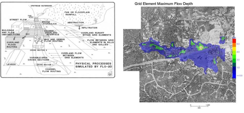
FLO-2D 由美國FLO-2D 公司發展之二維洪水災害模擬模式,為美國聯邦急難管理署(FEMA)認可之二維模式,可用於都市淹水、洪水平原管理、工程風險設計、不規則形狀河道水理演算、橋樑涵洞水理演算與滯洪池水理演算,可以處理漫地流、都市水文,泥流及土石流。
FLO-2D 淹水模式採用一維變量模式與二維漫地流模式模擬一維渠道及二維漫地流之流況,並計算發生溢堤時,堤外渠道與堤內地表間水流之互動機制,能有效模擬本計畫區之淹水情形。渠道演算方式為利用連續方程式和動力波模式以有限差分方法進行模擬,能模擬流體流動的速度及深度,並推估合理的淹沒面積,作為災害影響範圍預測之工具。